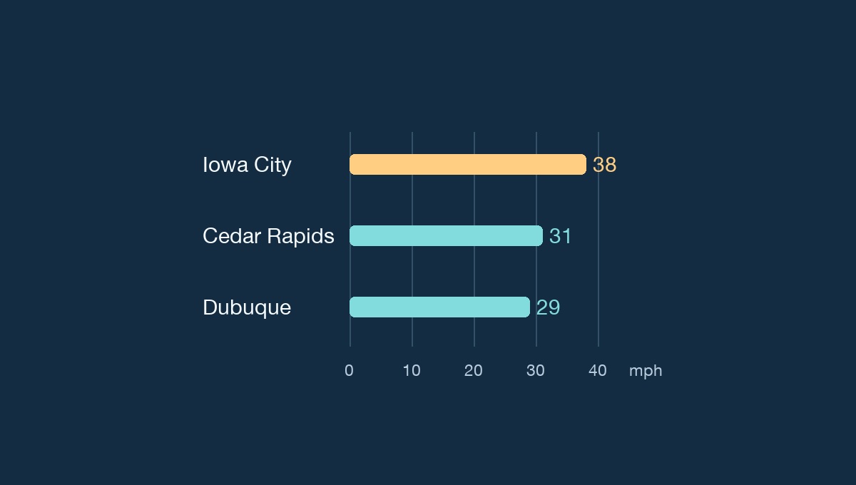
Iowa City’s airport reported a northwest gust of about 38 mph shortly before 1 p.m. Sunday, Nov. 22, after a cold front pushed through eastern Iowa. Cedar Rapids and Dubuque were also gusty at nearly the same time, with readings of about 31 and 29 mph, respectively. The airport observations show how much the wind varied even among three cities behind the same front.
What the airport readings show
At about noon, Iowa City reported a gust near 28 mph, compared with about 31 mph at Cedar Rapids. An hour later, Iowa City had the higher reading. Its gust was back near 31 mph just before 2 p.m. The station archive gives individual reports, so the comparison captures changes over those hours. The values are rounded from knots to miles per hour.
A colder night, then a dry start to the week
The National Weather Service office in the Quad Cities expected northwest winds to ease gradually after sunset, with lows widely in the 20s Fahrenheit. It forecast dry weather and light winds Monday and Tuesday. KCRG’s Sunday forecast also called for lighter winds and temperatures below freezing overnight.
For Thanksgiving travelers, the forecast becomes less settled after Tuesday. The weather service discussion put the chance of precipitation at 20% to 40% from Wednesday night into Thanksgiving across much of the eastern half of its forecast area. Forecasters said snow was possible and had low confidence in travel impacts because moisture and pavement temperatures were still uncertain. Check the latest local forecast before leaving.